In the northern corner of Vancouver Island, the North Coast Trail stretches roughly 38 miles and 3,450 ft of gain (about 61 km / 1,052 m) from Shushartie Bay to Cape Scott Trailhead (technically the trail ends at Nissen Bight, but most folks aren't picked up there). Going to Cape Scott and the lighthouse as a roundtrip adds about 13.5 miles and 960 ft of elevation (22 km / 292 m). This is a beautiful stretch of coastline with many empty and remote-feeling areas. There are lovely sandy beaches, cable car river crossings, and miles of muddy bogs to traverse.
North Coast Trail
To start the hike you have a few options: either take the water taxi from Port Hardy to Shushartie Bay, or start and end the trail from Cape Scott Trailhead, saving you money but doubling the miles.
We opted for the water taxi and decided to do the trail (plus Cape Scott) in a relaxed 5 days / 4 nights. A number of folks choose to do it in 6 or 7 days. The first part of the hike from Shushartie to Irony Creek felt like the toughest part; the trail got much easier after that, and Cape Scott is a very nice trail.
Trail conditions
All camps have metal bear-proof food caches.
Start of the trail from Shushartie
Day 1: Shushartie Bay to Nahwitti River Camp
7 miles and 1,181 ft gain (11.2 km and 360 m)
We set sail from Port Hardy at 7am and arrived at Shushartie at 8am — a beautiful ride and a fun way to start the hike! There is no dock in Shushartie Bay, so they get the boat as close as possible to the rocky shore and then you step off onto the rocks. This can be slippery and interesting if there are many waves.
The hike starts off with a fairly steep hill right off the bat. Fairly quickly though it levels off and the mud begins! This trail is famous for its mud. When we hiked, it had been unusually dry with little to no rain for three weeks. There was still plenty of mud, but I could imagine this being more challenging in wetter conditions. There were also some nice boardwalk sections to break up the mud.
We wore trail runners and no gaiters, and the mud never got over our ankles — some careful foot placement was required. After 5.5 miles (8.8 km) you finally get to the beach and have a chance to grab some water at Skinner Creek. This camp has an outhouse and locker as well as some tent sites in the trees.
Beach at Skinner Creek
We decided to keep going 1.5 miles to Nahwitti River Camp. Leaving Skinner Creek, you want a 9 ft (2.8 m) tide or lower. We got to camp at 3:50pm and enjoyed the sunshine on the beach. The water was flowing very slowly in the river (lots of algae) and we ended up walking a bit upstream before finding a place to filter. There are 3 tent platforms, an outhouse, and a bear locker here.
Day 2: Nahwitti to Irony Creek
8.5 miles and 957 ft gain (13.6 km and 291 m)
Nahwitti Cable Car
With another short mileage day ahead, we slept in and left camp around 8:35am. Pretty quickly we arrived at the cable car! This was quite fun — you pull the car over to your side of the river, get in, and see how far you get before pulling yourself to the other side. It can be a little tricky by yourself; you can bring a small cordelette and carabiner to help hold the car while you climb in or out. Gloves are a great idea. We got to see a pink fawn lily near the river here — very exciting!
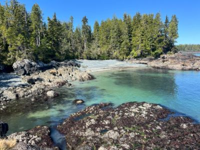
Lovely beach near Sutil
From the cable car you have two miles of forest walking before arriving at Tripod Beach (expect some mud!). For Tripod Beach you want an 8 ft (2.5 m) tide or lower. There are some lovely beaches here with some fun rock formations. You'll pop in and out of the forest before getting to Cape Sutil. We didn't see any running water in this area. After Sutil, the rest of the trail follows a similar pattern of popping into the trees and doing some brief inland sections before dropping back onto the beaches. I really enjoyed the coves and scenery in this area! This day definitely felt hard though — we all agreed it felt harder than all the mud the day before! We got to Irony Creek at 4:25pm and enjoyed another sunny evening at the beach. There are four tent platforms, an outhouse, and a bear locker.
Day 3: Irony Creek to Nels Bight
16 miles and 886 ft gain (25.7 km and 270 m)
A longer day of hiking! We got an earlier start and left camp at 7:40am. After a short walk on very nice sand you once again head into the trees. Another cable car gets you across the Stranby River, and then there's some more muddy forest walking before popping back onto the beach. After the cable car we noticed a lot of wolf scat. In a dense and brushy section of the trail, a wolf barked and growled at us. We stayed put and it growled again, and we heard some distant howls. After giving it some time we kept on walking to the beach — we never saw it, but it certainly got our heart rates up! Most of the beaches on this section have a bit of annoying rock walking — about grapefruit-sized and just a bit bothersome, with very little nice sand. We came across a black bear on the beach and had to detour around it, as it had no interest in moving.
We had a nice lunch break at Laura Creek and topped off our water bottles. Pretty soon after Laura Creek the trail goes into the woods for 3 miles. The bridge over Dakota Creek was out of commission when we were there, but it was easy to rock-step across the shallow creek. Hiking through the woods you pass a nice little lake — there's even some boardwalk! We definitely ran into some mud as well, but it wasn't too bad.
Bridge out over Dakota Creek
Nissen Bight was a welcome sight — very nice sand and easy walking! The North Coast Trail ends here, and we continued on the Cape Scott Trail. We looked in at Fisherman Bay and saw another bear on the beach. After another four miles on very easy and pleasant trail we were at Nels Bight. On the way to Nels you'll pass some interesting historical signs about the Cape Scott Community and the town that was once there. At the south end of Nels Beach is the water source — don't walk up the creek that feeds onto the beach. Instead, look for water signs in the forest and follow those to a nice creek.
Nels Bight at Sunset
Day 4: Out and Back to Cape Scott, then to Eric Lake
18 miles and 1,299 ft gain (30 km and 395 m)
When you see the notice board head towards the ocean and you'll see buoys marking the trail
We left camp at 8am and headed towards the Cape Scott Lighthouse. It was a fairly easy walk on an old plank road. Guise Bay was lovely and we enjoyed taking the optional trails to check out all the beaches in the area.
The lighthouse was small but fun to see — great views with friendly lighthouse keepers.
Cape Scott Lighthouse
After hiking back to Nels Bight and packing up our bags, we enjoyed a leisurely lunch and then started hiking out. We weren't sure whether to camp at Fisherman's Creek or Eric Lake, but we felt good and it was still early when we got to Fisherman's Creek, so we pushed on and arrived at Eric Lake at 6pm. The hike to Fisherman's Creek was a bit flat and repetitive with lots of boardwalk. Fisherman Creek had two tent platforms, an outhouse, and a bear locker — though the bathroom is quite close to the tent platforms, so it might not be ideal when the wind is blowing in the wrong direction. Eric Lake was huge with 10 tent platforms and four bear lockers, though only one bathroom. Luckily we had the place to ourselves.
Eric Lake
Day 5: Eric Lake to San Josef Bay and Cape Scott Trailhead
With a short day ahead, we slept in and left camp around 8:40am. After one and a half miles we came to the turnoff for San Josef Bay. A little over a mile later we were at the beach. The tide was low and the beach was gorgeous. The sea stacks were very pretty and there are a few caves to poke through. A fun swing kept us well entertained.
San Josef Bay
All too soon it was time to head to the trailhead to meet the shuttle. A mile and a half later we were at the trailhead around 11:40am — there is a nice covered picnic area if you have to wait for the shuttle in less-than-ideal weather. The shuttle arrived at noon and after a two-hour drive we were back in Port Hardy. A four-hour drive to the ferry, getting across the border, and much more driving later, we got back home just after 2am. An exhausting end to the hike! Next time I would probably spend the night in Nanaimo.
Cape Scott Trailhead
Final Thoughts
The trail was gorgeous and goes through some fun and wild-feeling terrain. We saw many otters, seals, and Steller sea lions. Seeing the two bears was exciting, and hearing the wolves is something we won't soon forget! We didn't encounter any bugs on the trail and the mud never got above the ankles. Taking the water taxi was definitely a fun (though expensive) way to start the hike — doing the trail as an out and back is certainly doable, but we were all glad we did it as a through hike.
Logistics
Getting to Port Hardy: From the mainland you can take the Connecting the Coast | BC Ferries from either Tsawwassen (south end) or Horseshoe Bay terminal (north) over to Nanaimo (Duke Point is the main terminal). You can reserve your spot on the ferry online.
Water Taxi and Shuttle: You can book your water taxi and shuttle pickup from Cape Scott at North Coast Trail Shuttle - Cape Scott Water Taxi. They run May 1 to September 15. During busy summer days they sometimes run two water taxis a day (leaving at 7am and 9am); otherwise they just do the 7am run when they have bookings. Minimum 4 people needed for the water taxi and 3 for the shuttle. In 2026, the price to Shushartie Bay was $150 CAD per person and shuttle pickup from Cape Scott was $125 CAD per person. Parking at their marina was $35 CAD for the week. You can also take the water taxi to Cape Sutil ($200 CAD per person, minimum 5 people) or get dropped off/picked up from Fisherman's Bay ($250 CAD per person, minimum 6 people). They can book out so reserve ahead — no refunds within 7 days.
Campsites
All designated campsites have a bear locker and outhouse; some have tent platforms. Some camps had a longer walk to water than others.
Distances Between Camps
From
To
Miles
Km
Shushartie Bay
Skinner Creek
5.5
8.8
Skinner Creek
Nahwitti Creek
1.5
2.4
Nahwitti Creek
Irony Creek
8.5
13.6
Irony Creek
Laura Creek
8
13
Laura Creek
Nissen Bight (east)
3.5
5.6
Nissen Bight(east)
Nels Bight
4.5
7.2
Nels Bight
Guise Bay
2.5
4
Guise Bay
Fisherman's Creek
7
11.2
Fisherman's Creek
Eric Lake
4
6.4
Eric Lake
San Josef Bay
2.5
4
Skinner Creek
50.86376, -127.97554
Beach or dirt campsites in the trees, outhouse, and bear cache. Nice sandy beach with water very close by.
Skinner Creek camp
Nahwitti Creek
50.85862, -128.00463
Three tent platforms, food cache and outhouse. Water was slow moving and slimy so we walked upstream about 10min to better flowing water.
Irony Creek
50.84356, -128.12174
Four tent platforms, outhouse, bear cache and easy access to water. A little bit of sandy beach as well!
Laura Creek
50.80849, -128.23936
Lots of places to camp on a nice, flat sandy beach. Outhouse and bear caches provided. Nice camping options on the beach or by the river. The river is a little way away from the bear cache (about 800ft away or 243 meters).
Laura Creek Camp
Nissen Bight
East end of camp (water): 50.79881, -128.29302 | West end of camp: 50.79490, -128.30877
A nice sandy beach with two camping options. There is an outhouse and bear cache on both the east and west ends of the beach. The water is on the east side. From the bathroom it is still a bit of a walk (10–15 min). For both the east and west, camping is on the beach.
Nels Bight
50.78402, -128.36163
Water is only at the end of the beach, bathrooms are in the middle and bear boxes are throughout.
Guise Bay
50.77217, -128.40292
A lovely sandy beach with bear cache, camping on the beach and an outhouse.
Fisherman's Creek
50.74816, -128.30517
Two tent platforms, bear cache and outhouse. Note the outhouse is a bit close to the tent pads so smell could be an issue. Water from the creek is close by but you can't see the creek from camp.
Eric Lake
50.70227, -128.26604
10 tent platforms built when we visited but fresh wood piles look like they might build three more. One bathroom and four medium sized bear lockers. The lake is a quick walk on boardwalk from camp.
San Josef
50.67422, -128.27500
Lots of places to camp on a nice, flat sandy beach. Outhouse and bear caches provided.